9-Day US Southwest Road Trip Itinerary: A Day-by-Day, Winter-Friendly Route Through Arizona & California
This entry may contain affiliate links. This means if you click a link in this post and make a purchase, I may earn a small commission at no additional cost to you.
In this winter-friendly road trip itinerary, I share the 9-day US Southwest road trip route I road-tested in December. No snowed-in highways, closed campgrounds, or obnoxiously cold nights, just scenic drives, day-of availability at campgrounds, and maximum diversity from desert to pine forest.
When I set out on my 9-day Southwest road trip in early December, I had a simple goal: follow the warmth. By prioritizing lower-elevation desert landscapes and avoiding snow-prone mountain passes, I found a route that stayed in the sunny 60s while the rest of the country was freezing.
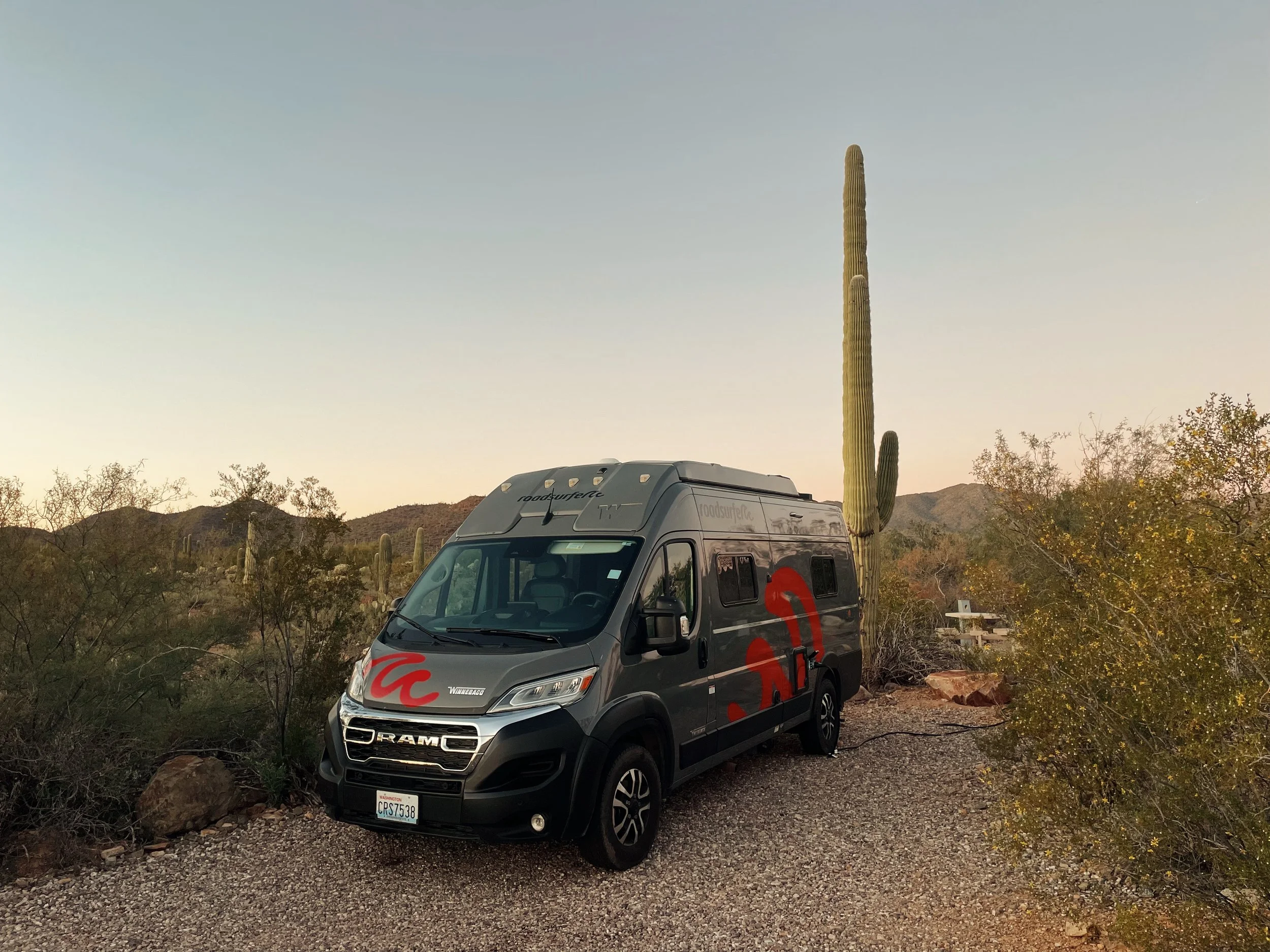
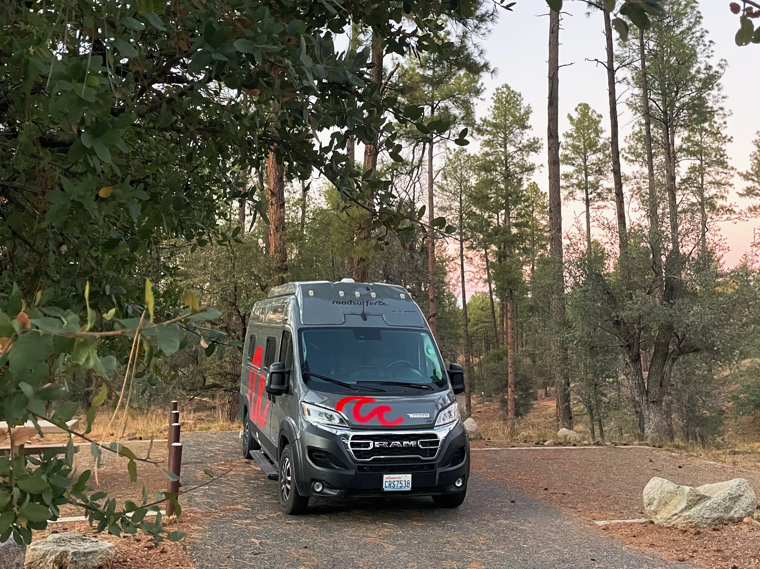
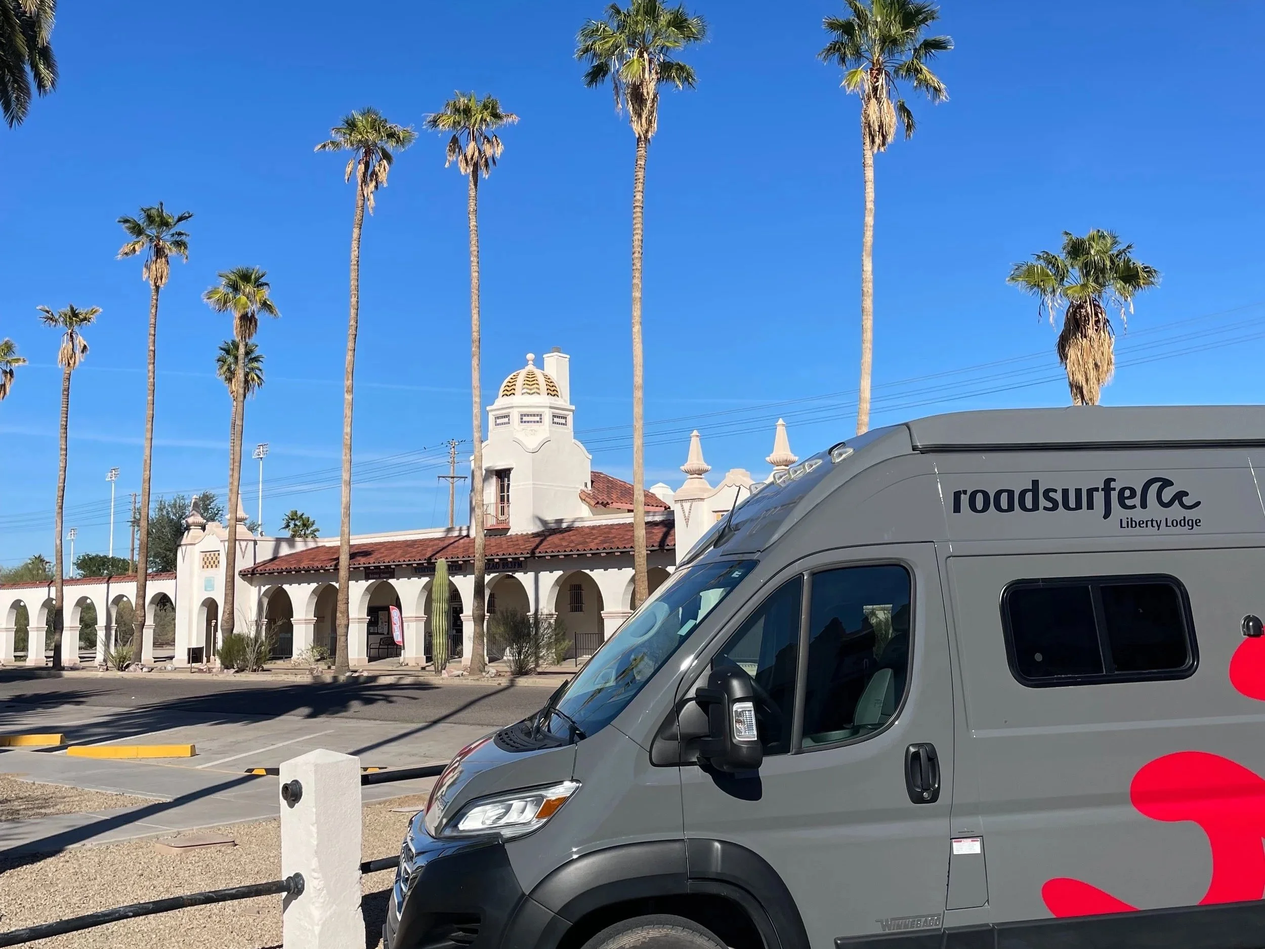
I traveled in a Roadsurfer’s Liberty Lodge campervan equipped with a parking heater, but this route is designed so that even without one, you can stay comfortable. It turned out to be a surprisingly easy, repeatable route through Arizona and California—one I’d happily do again.
Why This Southwest Road Trip Route Works in December
Lower Elevations: We stay out of the high-altitude "snow zones," focusing on the Mojave and Sonoran deserts.
Mild Weather: Expect sunny, 60-degree days. While nights dip into the 30s and 40s, the roads stay clear and the hiking is perfect.
Accessibility: Most days involve just 2–4 hours of driving, accounting for the shorter daylight hours in winter.
Open Roads: Unlike the North Rim of the Grand Canyon or high mountain passes, these parks and highways remain fully accessible all winter long.
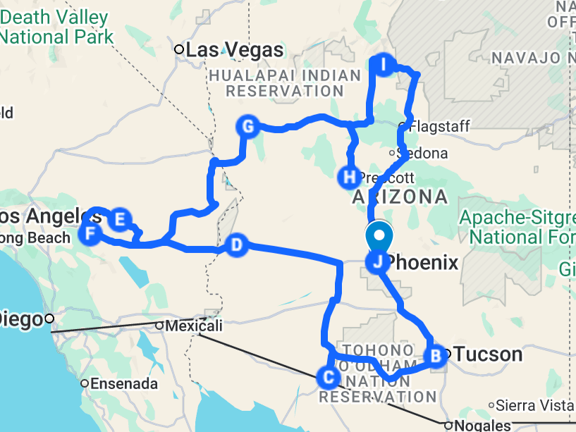
Winter-Friendly Southwest Road Trip Route at a Glance
Duration: 9 Days
Start/End: Phoenix, AZ
Best Time to Go: December – March
Highlights: Saguaro NP, Joshua Tree NP, Grand Canyon, Historic Route 66, and Palm Springs.
Before You Go: Essential Logistics for Your Southwest Road Trip
The America the Beautiful Pass
Since this route hits Saguaro, Organ Pipe Cactus, Joshua Tree, and the Grand Canyon, this $80 annual pass is the most cost-effective way to cover your entry fees. Get the digital pass.
Choosing Your Vehicle
Campervan/RV: I rented from Roadsurfer in Phoenix. It made it easy to stay inside the parks and be the first on the trail.
Car + Hotels: This itinerary is incredibly flexible. If you prefer a bed, you can easily find hotels in Tucson, Palm Springs, Kingman, and Flagstaff.
Apps I Used For This Road Trip
AllTrails Plus: Essential for offline trail maps when cell service disappears.
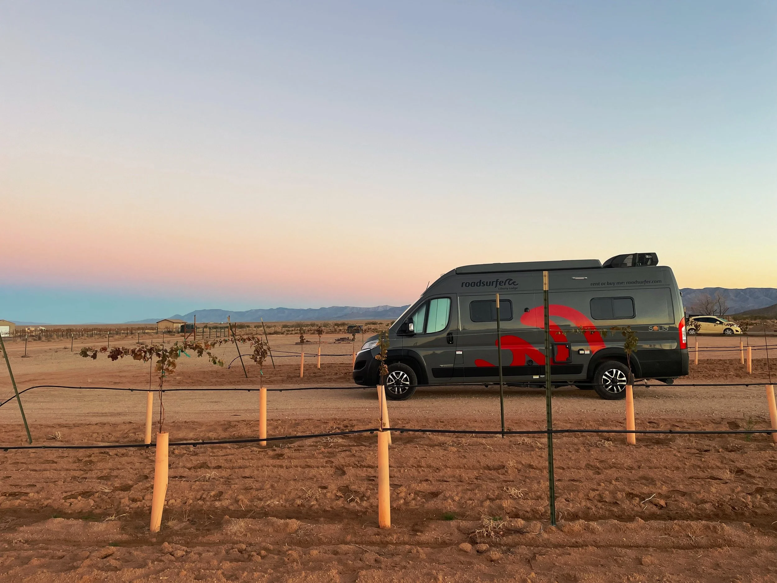
Harvest Hosts or RV Overnights: Great for finding unique overnight stays at wineries or farms, including that epic vineyard I stayed at on Day 6 of this itinerary.
Google Maps (Offline): Download the Arizona/Southern California region before you leave!
ChatGPT: My "secret weapon" for finding scenic lunch spots or propane refills on the fly.
Booking Campgrounds
National park campgrounds book via Recreation.gov, many require a digital reservation
First-come, first-served campgrounds are noted clearly
Winter availability is better than peak season, but popular parks (Joshua Tree, Grand Canyon) still fill up, especially on weekends, and sometimes have fewer loops open, meaning fewer sites available.
Let’s dive into the itinerary. This is the 9-day road trip route through the Southwest U.S. that I drove in December. I wrote this with the intention that you’ll have this post open on your phone at the start of each day and as you drive, giving you the day’s route at a glance, where to have a campsite booked for day’s end, and the recommended route to follow for the most scenic drive.
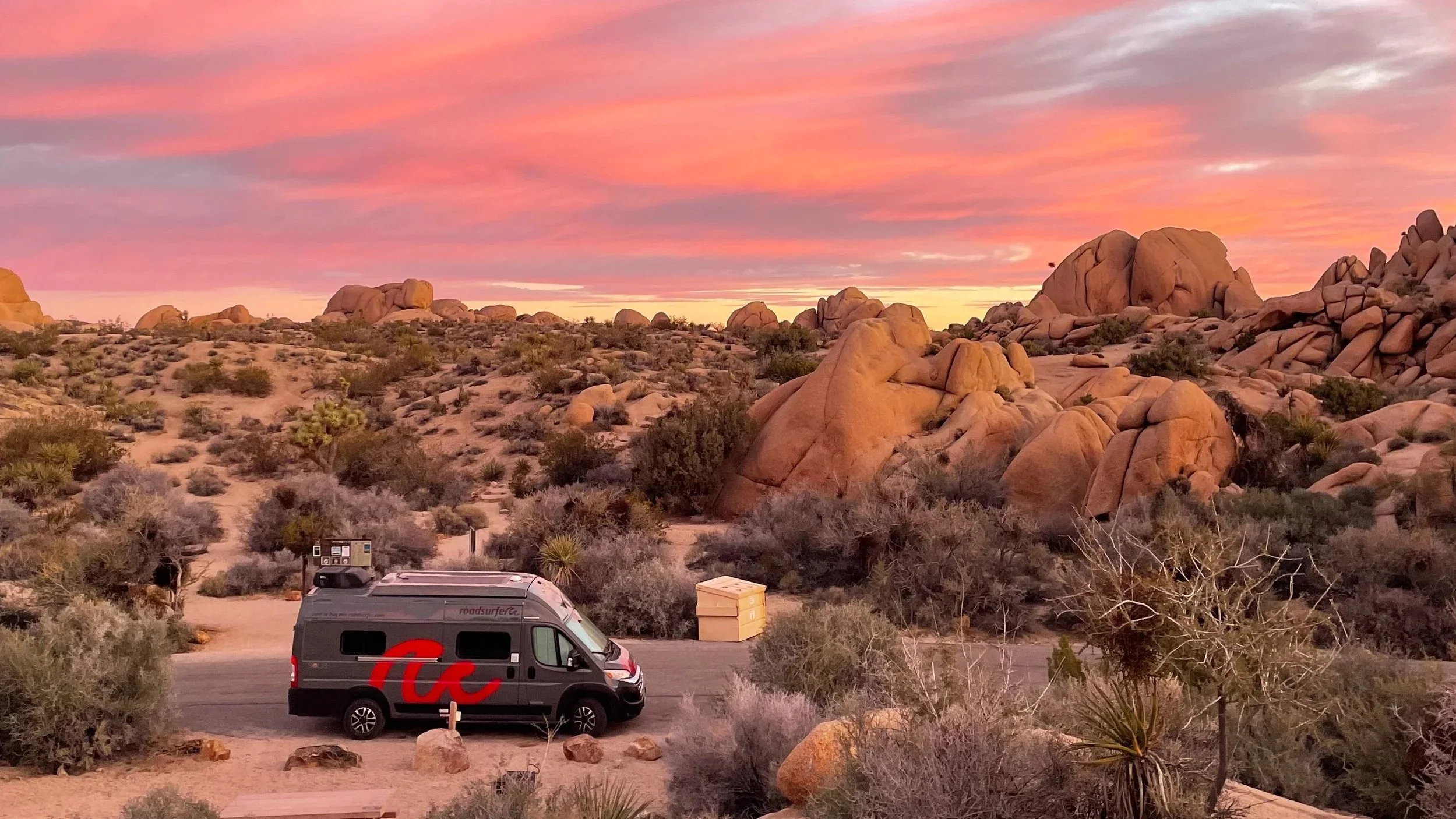
Day 1: Phoenix to Saguaro National Park (West)
Overview: Ease into the road trip with a short, scenic introduction to the Sonoran Desert. Today is about desert orientation: saguaros on the horizon, wide western skies, and a first night camping next to saguaros just outside Tucson.
Route at a Glance
Start: Phoenix, AZ
End: Gilbert Ray Campground / Saguaro National Park / Tucson Mountain Park — check availability (Pima.gov) or get directions (Google Maps)
Recommended route: Phoenix → Florence via US-60 / AZ-79 → Tucson via AZ-287 / AZ-87 / I-10 → Saguaro National Park West → Gilbert Ray Campground
Total drive time (no stops): ~2.5 hours
Why this route: Rather than rushing straight south on the interstate, this route eases you into the desert landscape and adds a worthwhile cultural stop in Florence before continuing toward Tucson and the saguaro-studded hills west of the city.
Stop 1: Florence, Arizona
Why stop: A historic desert town from the 1870s with a compact, walkable center—perfect for stretching your legs and grabbing coffee or lunch.
What to do: Walk around downtown Florence, browse local shops, and take in the old adobe buildings, many of which are listed on the National Register of Historic Places
Where to eat: Florence Fudge Shop & Café—a classic, no-frills stop for lunch or a sweet treat.
Tip: This is a relaxed stop—30–60 minutes is plenty unless you want to linger.
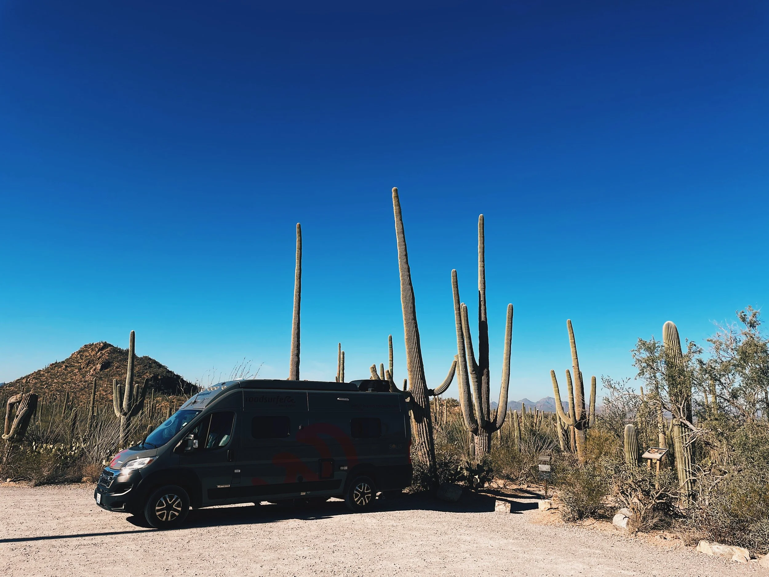
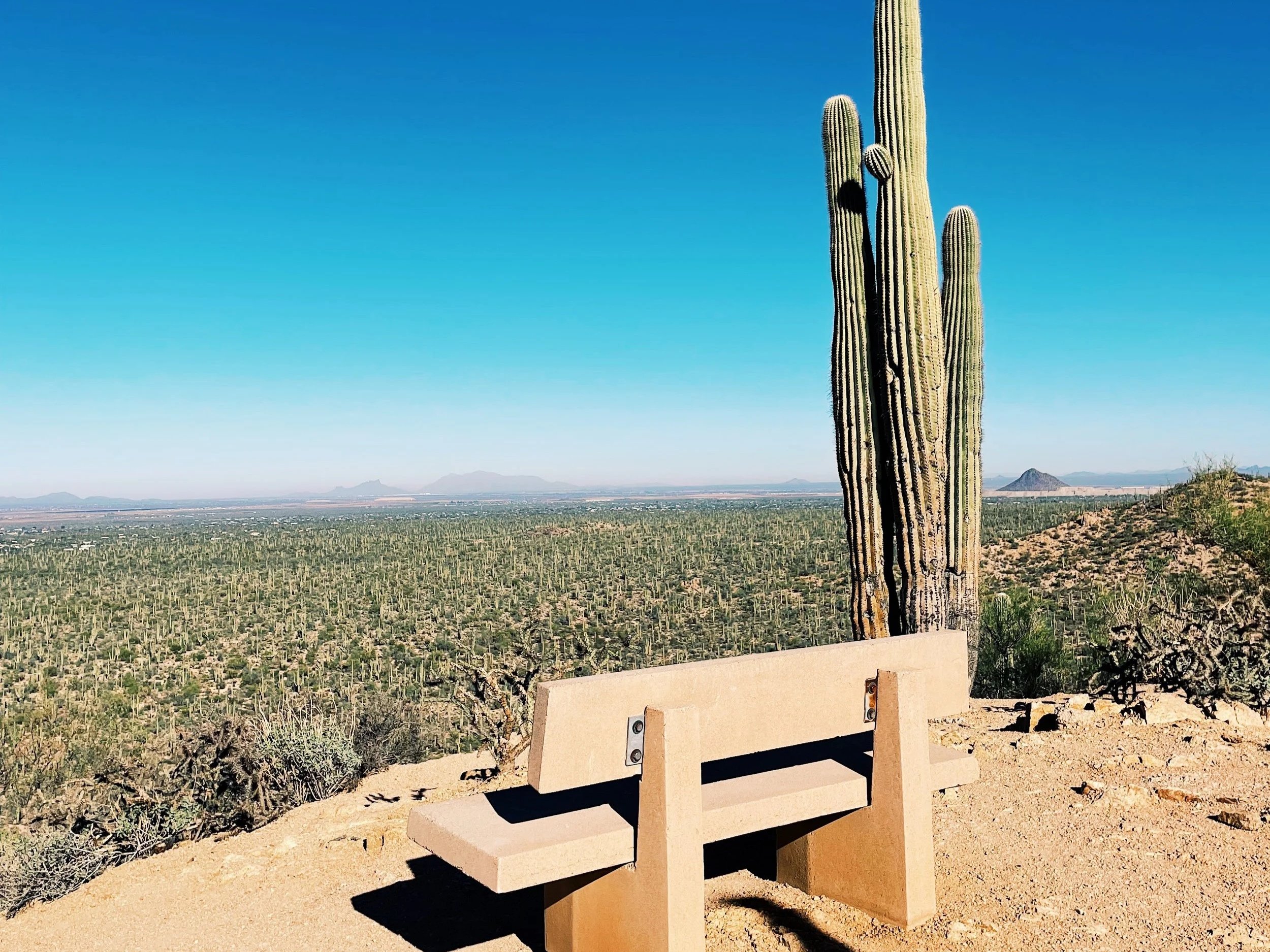
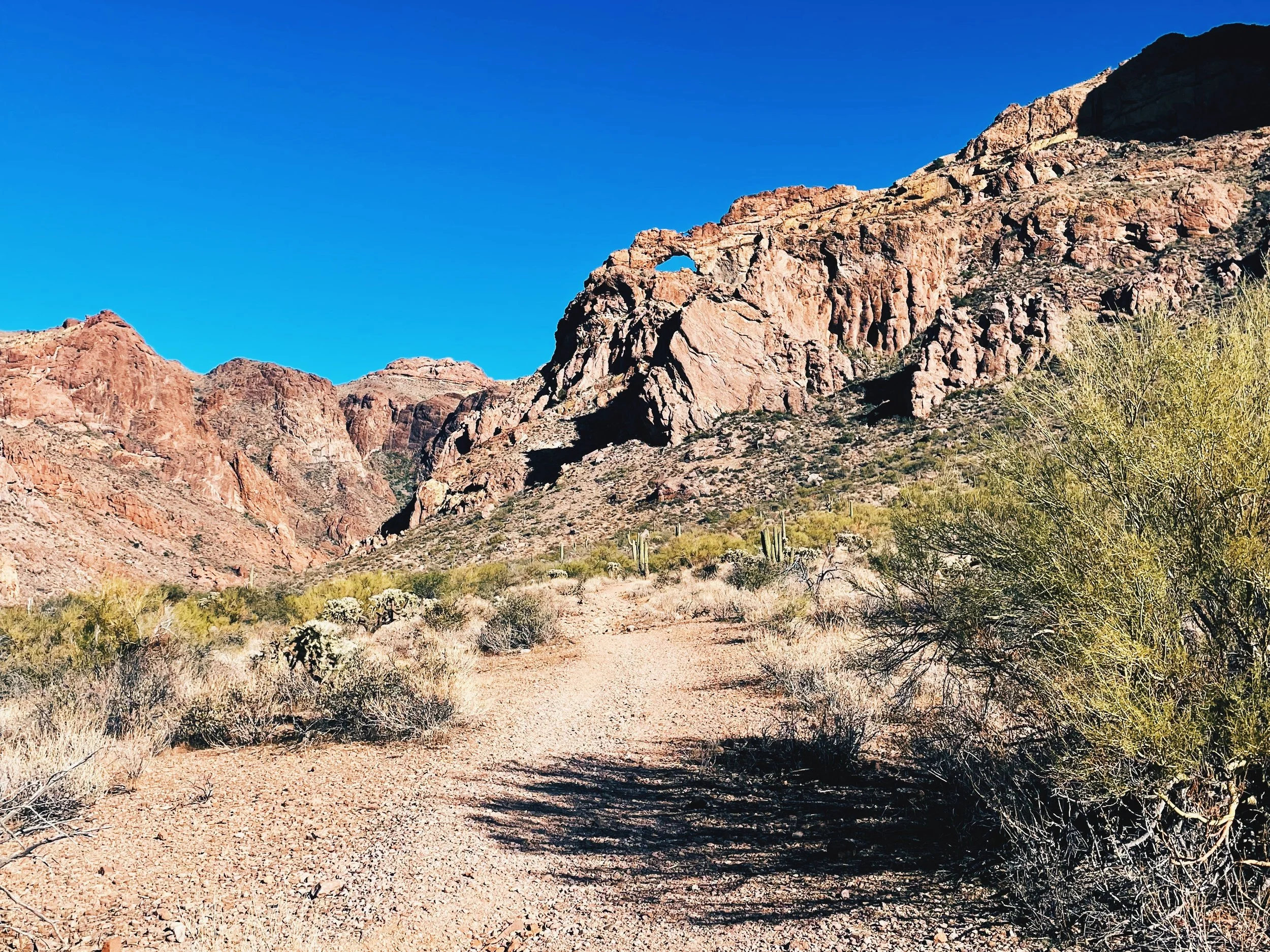
Stop 2: Saguaro National Park (West District)
Park pass required: Yes
America the Beautiful Pass accepted
Otherwise, purchase a Saguaro National Park entrance pass (valid for 7 days)
Why West over East: Saguaro National Park (West) feels more rugged and immediately scenic, with dense stands of saguaro cacti and dramatic desert light—especially in the late afternoon. Shaka Guide says West Saguaro is also the more popular of the two, because there’s more to access, including the Old Tucson movie set and the Arizona-Sonora Desert Museum, not to mention plenty of day hikes, loop drives, and the park visitor center.
Recommended scenic drive:
Bajada Loop Drive: a beautiful introduction to the park that winds through dense cactus forest and offers frequent pullouts and viewpoints. Portions are unpaved but generally accessible for campervans and big rigs in dry conditions (check recent weather if it has rained).
Suggested walk (what I did):
Valley View Overlook Trail (0.8 miles, easy): a short, rewarding walk that leads to a wide desert overlook (see photo above). This is an ideal first trail in Saguaro: low effort, big payoff, and perfectly timed for golden hour if you arrive in the afternoon.
Other great trail options, depending on time and energy:
Signal Hill Petroglyphs Trail (0.3 miles, easy): short and flat, with ancient petroglyphs carved into volcanic rock
Gould Mine Loop (2.5 miles, moderate): a moderate loop that combines desert scenery with a historic mine site
Wasson Peak (7.9 miles, moderate): the park’s highest point and a more ambitious hike if you want a challenge and sweeping views
For more trail ideas and current conditions, I recommend browsing AllTrails’ roundup of the best hikes in Saguaro National Park.
Timing note: If you’re road tripping in the wintertime, aim to arrive mid-to-late afternoon to enjoy softer light on the saguaros before heading to camp. The sun sets around 5:30 pm in the winter months. If you arrive too late in the day to squeeze in a hike or drive, you could always do it the next morning before you hit the road.
Overnight: Gilbert Ray Campground
Suitable for: Campervans, RVs (up to 40 feet), and tents
Location: Gilbert Ray Campground, 8451 W McCain Loop, Tucson, AZ 85735 (see on Google Maps)
Booking: Reservation-only through Pima County (pima.gov)
Why stay here: Spacious sites with electrical hookups, stunning desert views, and close proximity to the park without needing to drive back into Tucson.
Facilities: Toilets (no showers), dump station, potable water fill-up station, 20-, 30-, and 50- amp electrical hookups, good cell signal
Pack rat precautions: Pack rats are known to inhabit this area and can occasionally nest in vehicle engine compartments. Common prevention tips include leaving a light on under your vehicle or in the engine bay at night, popping your hood after parking, and gently tapping the hood before driving in the morning. (My experience: I did not take these precautions and had no issues—but it’s worth being aware and deciding your own comfort level.)
Day 2: Saguaro National Park to Organ Pipe Cactus National Monument
Overview: Today is about remoteness and transition. You leave the familiar desert around Tucson and travel deeper into a wilder, quieter Sonoran landscape, passing through Tohono O’odham Nation lands before ending the day among one of the largest natural concentrations of organ pipe cactus in the United States.
Route at a Glance
Start: Gilbert Ray Campground / Saguaro National Park West
End: Twin Peaks Campground / Organ Pipe Cactus National Monument — check availability (Recreation.gov) or get directions (Google Maps)
Recommended route: Tucson area → Ajo via AZ-86 through Tohono O’odham Nation → Organ Pipe Cactus National Monument via AZ-85
Total drive time (no stops): ~3 hours
Why this route: AZ-86 is the most direct way to reach Ajo and Organ Pipe National Monument and offers a striking sense of place as you pass through Tohono O’odham country—wide-open desert, long horizons, and very little traffic. Services are sparse, which adds to the feeling of going somewhere truly remote.
Important Note: Driving Through Tohono O’odham Nation
Today’s route passes through sovereign tribal land, so keep these points in mind:
Follow posted speed limits and signage — tribal police strictly enforce them.
Stick to paved main roads (e.g., U.S. Highways). Secondary or dirt roads may be impassable, require 4WD, or be off-limits.
Plan ahead for services: gas stations and amenities are very scarce. Fill up before leaving Tucson, carry extra water, and don’t rely on cell service.
Respect local culture: do not enter off-limit areas, avoid photographing people without permission, and follow any guidance for cultural or religious sites.
Alcohol laws: Many tribal lands are “dry.” Possessing, consuming, or transporting alcohol can lead to serious legal consequences — even in transit through the territory.
Expect Border Patrol checkpoints — standard in this region.
Drive mindfully: this stretch is quiet, expansive, and culturally significant, so enjoy the scenery respectfully.
Stop 1: Ajo, Arizona
Why stop: A small desert town with a surprising amount of history, art, and Spanish Colonial charm—and the last good services before Organ Pipe and the campground.
What to Do: Spend time wandering the historic Ajo Plaza, where informational signs explain the town’s copper-mining history and transformation over time. Look for the Artist Alley Murals, a colorful and unexpected outdoor gallery tucked just off the plaza.
Coffee & Fuel-Up: Oasis Coffee—a welcome caffeine stop before heading deeper into the monument, with seating indoor and out along Ajo’s pretty plaza.
Tip: This is a great place to top off gas, water, and snacks. Cell service becomes unreliable once you leave town.
Stop 2: Ajo Mountain Loop
Why drive it: The Ajo Mountain Loop is a stunning loop drive showcasing organ pipe cacti, volcanic rock formations, and vast desert views, plus a few trails you can get out and walk along the way
What to know: Mostly graded, one-way, 21-mile dirt road; generally suitable for vehicles (no longer than 25 feet) in dry conditions (check weather and park advisories or ask the rangers at the Kris Eggle Visitor Center before you begin); typically takes about 2 hours to drive at a leisurely pace with stops; expect no cell phone signal (download the AllTrails offline map — includes key stops on the route)
Park pass required: You’ll need either the America the Beautiful pass or an Organ Pipe Cactus National Monument pass, which you can purchase at the Kris Eggle Visitor Center or online at Recreation.gov.
Overnight: Twin Peaks Campground
Suitable for: Campervans, RVs (up to 45 feet), and tents
Location: Twin Peaks Campground, 47 Organ Pipe Dr, Ajo, AZ 85321 (see on Google Maps)
Booking: Reservation-only. Same-day reservations may be available, but all payments must be made through Recreation.gov.
Why stay here: Quiet, dark-sky camping surrounded by cactus forest, with unbeatable sunset and sunrise light.
Facilities: Flush toilets, solar-heated showers, RV dump station, potable water fill-up station, no RV hookups, designated sites for generator use (RV sites #1-#112, permitted 8 am to 10 am and 4 pm to 6 pm only), some cell coverage
Pass required: Organ Pipe Cactus National Monument charges an entrance fee separate from the camping fee. You may pay the fee upon arrival at the Kris Eggle Visitor Center during business hours or pay the entrance fee online in advance using a credit or debit card. If you have the America the Beautiful pass, you’re all set.
Pack rats: Take precautions, like popping your vehicle’s hood at night and leaving a light on underneath or inside the engine bay
Border proximity: The southern boundary of Organ Pipe Cactus National Monument is the United States border with Mexico. While it is unlikely that you will encounter any illegal border activity, you should be aware of what to do should that situation occur. To ensure your personal safety, you can read the Border Crossings section on the park’s Safety page.
Day 3: Organ Pipe Cactus National Monument to Joshua Tree National Park (South Entrance)
Overview: This is a longer drive day, but a satisfying one. You cross from the Sonoran Desert into the Mojave, watching the landscape subtly (and then dramatically) change—fewer saguaros, more open basins, and eventually the surreal forms of Joshua trees themselves.
Route at a Glance
Start: Twin Peaks Campground / Organ Pipe Cactus National Monument
End: Jumbo Rocks Campground / Joshua Tree National Park — check availability (Recreation.gov) or get directions (Google Maps)
Recommended route: Organ Pipe Cactus National Monument → Quartzsite → Joshua Tree National Park (South Entrance) via AZ-85 → I-10 → Cottonwood Springs Road
Total drive time (no stops): ~5.5–6 hours
Why this route: AZ-85 provides a quiet, scenic exit from Organ Pipe before connecting with I-10 for a straightforward east–west crossing. Entering Joshua Tree via the south entrance allows you to experience the park gradually, driving north through changing desert zones rather than dropping straight into the busiest areas.
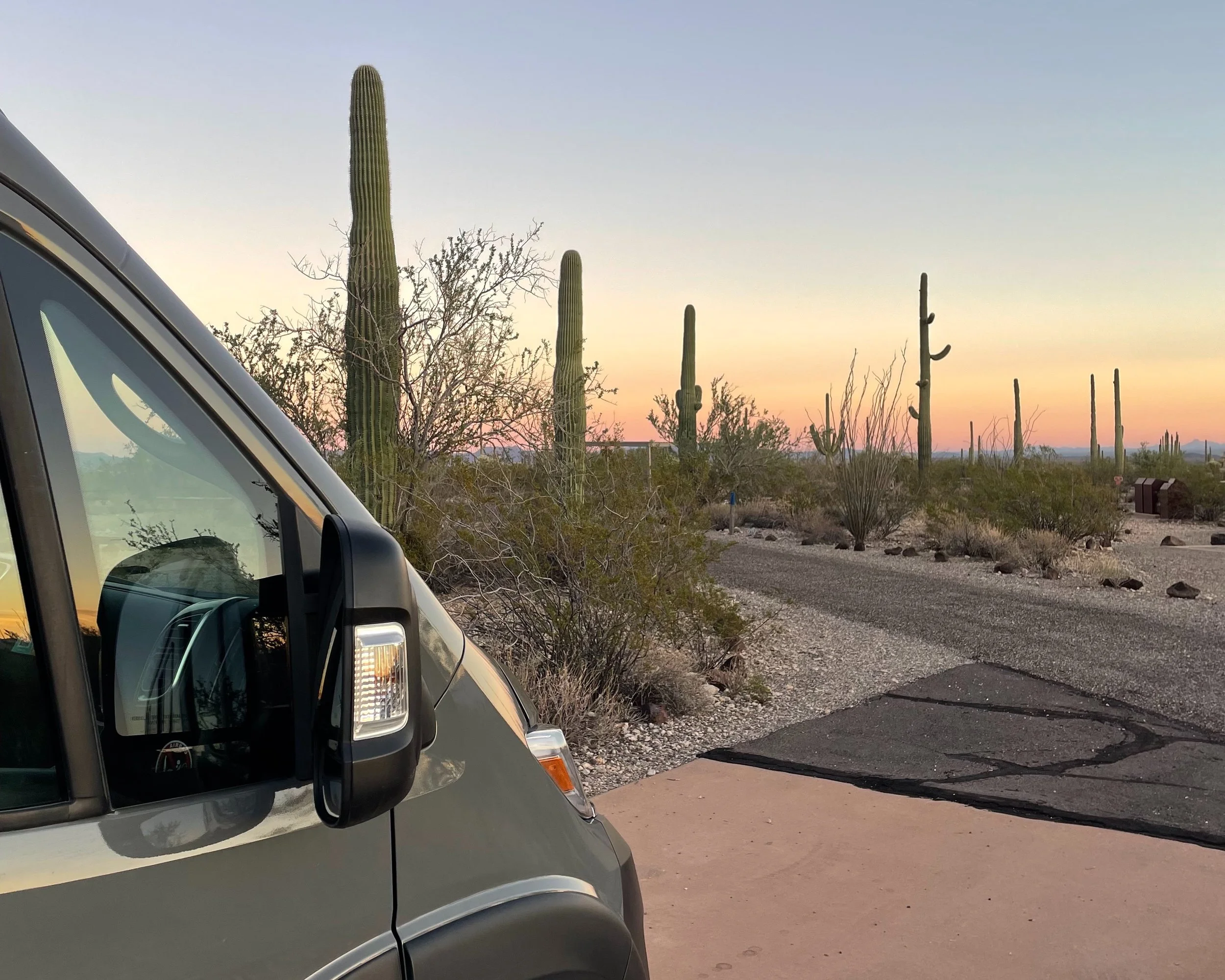
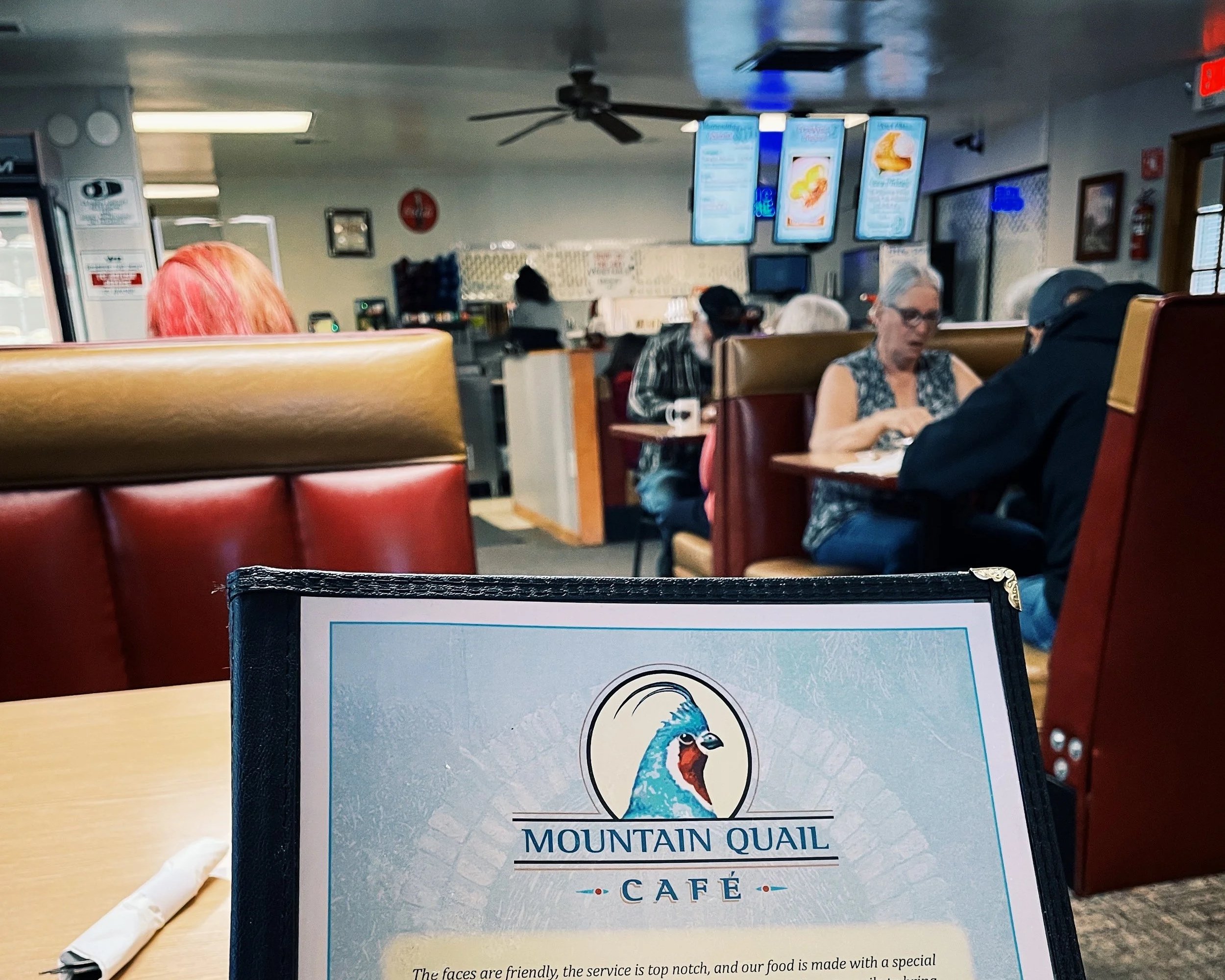
Stop 1: Quartzsite, Arizona
Why stop: A classic desert crossroads town and a convenient midway break for food, fuel, and supplies just before crossing into California, where gas prices can get as high as $5/gallon.
Where to eat: Mountain Quail Café—an old-fashioned, no-frills diner with breakfast served all day and bottomless coffee. A perfect comfort-food stop on a long drive.
Stop 2: Joshua Tree National Park (South Entrance)
Park pass required: Yes
America the Beautiful pass accepted
Otherwise, purchase a Joshua Tree National Park entrance pass (valid for 7 days)
Why enter from the south: The Cottonwood Springs area sits at a lower elevation and eases you into the park, letting the scenery shift gradually as you drive north toward the park’s iconic granite rock formations. This approach feels expansive and calm, especially compared to the often-busy west and north entrances.
Overnight: Jumbo Rocks Campground
Suitable for: Campervans, RVs (up to 40 feet), and tents
Location: Jumbo Rocks Campground, Park Blvd, Twentynine Palms, CA 92277 (see on Google Maps)
Booking: Reservation-only. Same-day reservations may be available on weekdays in the winter months, but all payments must be made through Recreation.gov. This is a popular campground, so you’ll definitely want to book days, maybe even weeks, ahead of time.
Why stay here: One of the most iconic campgrounds in the park, surrounded by massive boulder piles and some of the best sunrise and sunset light in Joshua Tree. It’s also situated just next to the Skull Rock Trailhead, which connects with other trails like the Split Rock Loop and Discovery Trail.
Facilities: Vault toilets, no electric, water, or sewer hook-ups available at individual campsites, no dump station, generator use is permitted only from 7–9 am, noon–2 pm, and 5–7 pm, limited to no cell service (I have AT&T and had no signal at Jumbo Rocks)
Sites: Many are exposed, so you can expect wind and temperature swings. I booked site 93 and found it to be more sheltered and private from other campers than most sites, but it is right across the street from the trailhead for Skull Rock.
Days 4–5: Joshua Tree National Park
Overview: Instead of rushing through Joshua Tree, this itinerary is designed around staying put for two nights and experiencing the park at different times of day—sunrise hikes, afternoon town exploration, sunset desert light, and dark-sky nights. Below is how I spent these two days, offered as a flexible menu you can mix and match based on energy, weather, and season.
Where to Camp in Joshua Tree National Park
These campgrounds all place you close to central park highlights:
Jumbo Rocks Campground (reservation required via Recreation.gov)
Central location among massive boulder formations
Excellent sunrise, sunset, and stargazing
Exposed sites—expect wind and temperature swings (I recommend Site 93)
White Tank Campground (first come, first served - register & pay at north entrance)
Smaller, quieter campground with 15 sites
Access to the Arch Rock Trail directly from camp
Good option if Jumbo Rocks is full
Belle Campground (first come, first served - register & pay at north entrance)
Similar central location to White Tank
Slightly more sites (18 total), still feels tucked into the rocks
Idea 1: Take a Day Trip to Palm Springs
Palm Springs is an hour and a half drive west from Joshua Tree National Park, and the drive to it is as dramatic as they come with the San Jacinto Mountains looming larger with every mile. Once within its mid-century modern atmosphere, snag a free parking spot along Palm Canyon Drive and wander the shops, restaurants, breweries, and cafes. I can vouch for Ernest Coffee if you need a caffeine pick-me-up.
Some other ideas for how to spend the day are:
Palm Springs Architecture, History & Bike Tour: A guided way to explore the city’s iconic mid-century neighborhoods, with context on the architects, homes, and design movement that put Palm Springs on the map. A celebrity-focused bike tour (or golf cart tour) is another fun option if you’re curious about the Palm Springs homes of celebrities from old Hollywood and modern-day.
Museums: The Palm Springs Air Museum and Palm Springs Art Museum are both worth visiting, depending on your interests and the weather.
Palm Springs Aerial Tramway: Ride from the desert floor up into the San Jacinto Mountains, where temperatures are cooler and views stretch across the valley. It’s a great contrast to the low desert landscapes around Joshua Tree.
Palm Springs is also a good place to restock groceries or grab any supplies you want for back at camp.
Idea 2: Spend the Day at a Spa, Soaking in Mineral Springs
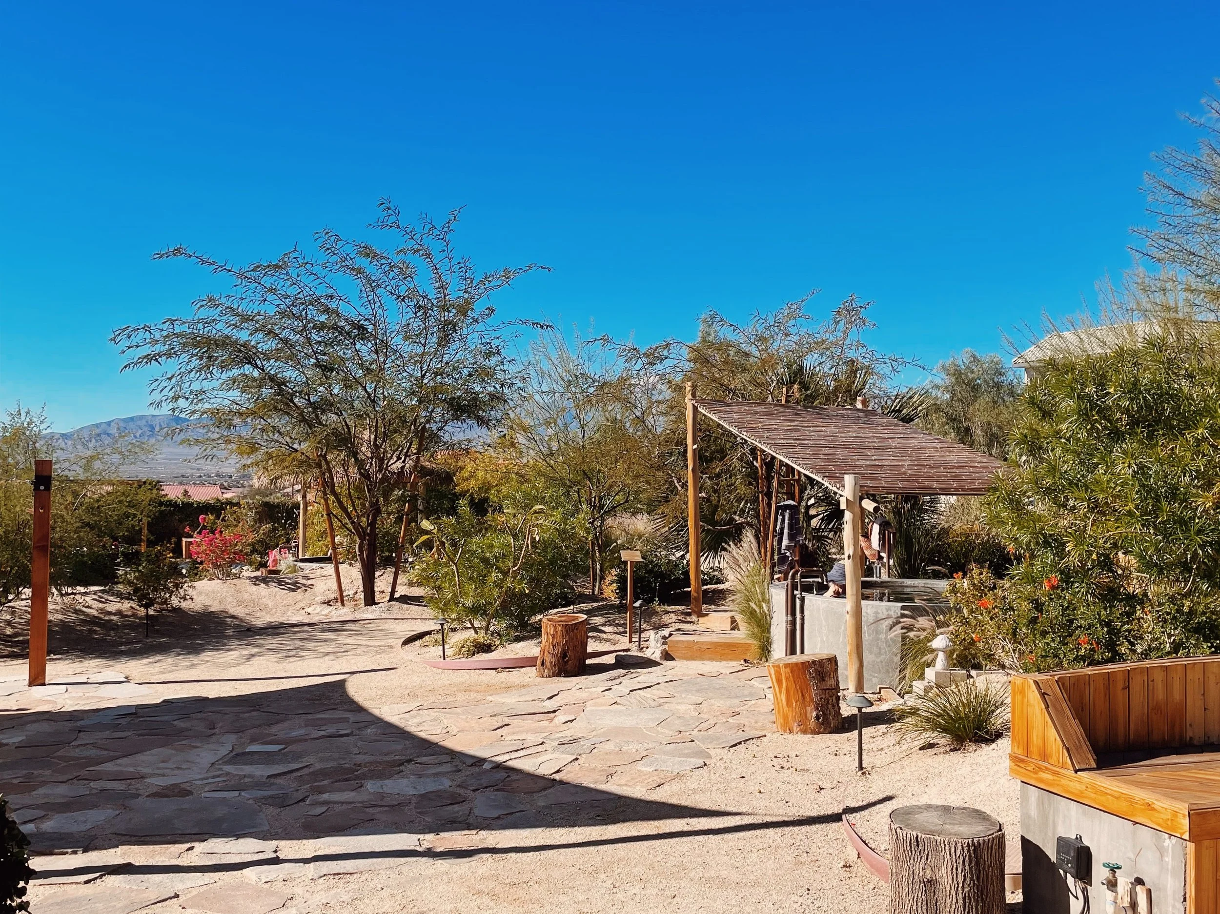
There are so many spas within the Palm Springs area that offer day passes to their spas and mineral springs. For an affordable and no less luxurious option, look into Azure Palm Hot Springs Resort in Desert Hot Springs. Their day pass is $69 on weekdays and $79 on weekends. That price includes access to their mineral hot springs pools, outdoor swimming pool, a sauna with ice bucket shower, and multiple hot tubs. They also provide a robe, slippers, and towel when you check in for no extra fee. A day pass grants you access from 9am to 7pm.
Idea 3: Hike Ryan Mountain
Ryan Mountain is one of the most popular hikes in Joshua Tree National Park—and for good reason. The trail climbs steadily to one of the best panoramic viewpoints in the park, offering sweeping views across both the Mojave and Colorado Desert ecosystems.
Trail length: ~3 miles round-trip
Difficulty: Moderate (consistent incline, fully exposed)
Why it’s worth it: Big, expansive views with relatively low mileage
Plan to hike Ryan Mountain early in the morning for fewer crowds, but pack layers as it’s really windy and cold up top. From the summit, you’ll see Joshua tree–dotted valleys, rugged rock formations, and distant mountain ranges stretching in every direction, some even snow-capped. This hike pairs especially well with a slower afternoon in Joshua Tree Town or a relaxed day back at camp.
Idea 4: Explore Joshua Tree Town
After a morning hike, head out of the park by way of the west entrance toward Joshua Tree town for a low-key afternoon of wandering and refueling. Here are some spots I loved visiting:
Joshua Tree Coffee Company — a classic stop for coffee, cold brew, or a midday pick-me-up
The Crochet Museum — a quirky roadside art installation that’s quick to visit and uniquely Joshua Tree
Space Cowboy Books — an independent bookstore with an eclectic selection of sci-fi books
Nomadic Ceramic — local artisan ceramics by Grace Alley worth browsing
Spend time browsing the local gift shops, vintage stores, and small galleries along the main drag
Joshua Tree town is also a convenient place to restock groceries, water, ice, or fuel before your next travel day.
Idea 5: Cholla Cactus Garden at Sunset
End one of your days with a sunset visit to the Cholla Cactus Garden, one of the most visually striking areas of the park.
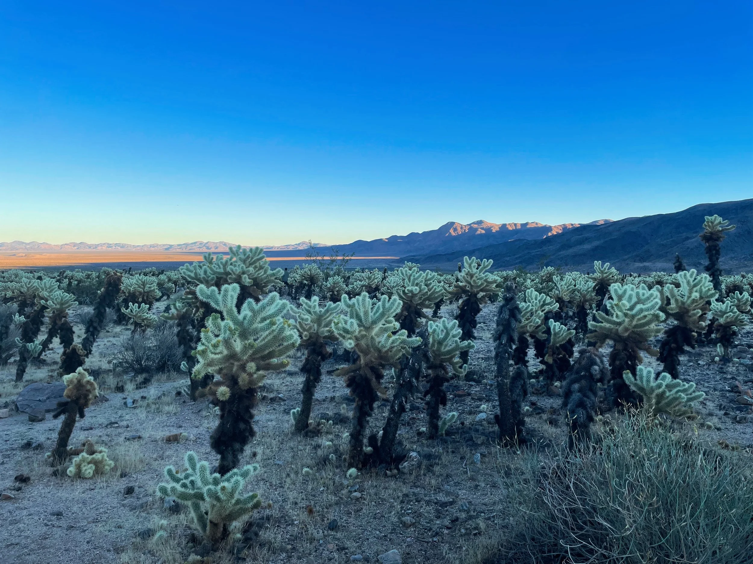
Arrive before sunset to walk the short loop trail as the light softens and the cholla begin to glow—especially when backlit during golden hour. As the sun dips lower, the landscape shifts from warm tones to cooler hues, making this an easy but memorable evening stop.
Tip: Cholla are beautiful but notoriously barbed—closed-toe shoes and mindful footing are strongly recommended.
Day 6: Joshua Tree National Park to Kingman, Arizona (Route 66)
Overview: Today is a classic American road trip day—long, scenic, and layered with history. You leave the high desert of Joshua Tree, cross the Colorado River into Arizona, and spend much of the day tracing iconic stretches of Historic Route 66 before ending the night among vineyards just outside Kingman.
Route at a Glance
Start: Joshua Tree National Park
End: Valle Vista (outside Kingman, AZ)
Recommended route: Joshua Tree / Twentynine Palms → CA-62 → Parker, AZ → Lake Havasu City → Kingman (via Historic Route 66)
Total drive time (no stops): ~4 hours
Why this route: Highway 62 out of Twentynine Palms is seriously stunning—wide-open desert, distant mountains, and very little traffic. Crossing into Arizona via Parker allows you to follow the Colorado River before reconnecting with Route 66 and leaning fully into the nostalgia of the drive.
Morning: Joshua Tree to Parker, Arizona
Drive highlight: CA-62 from Twentynine Palms
One of the most underrated desert highways in Southern California
Expansive views that will have your jaw on the floor
After crossing into Arizona near Parker, pull off near the Colorado River for a scenic lunch break (there’s a pull off—roughly here on Google Maps—just after Parker Strip and before the Bill Williams Memorial Bridge that’s perfect this!). This stretch offers a rare chance to sit by water in the middle of an otherwise arid landscape.
Tip: Have your car or van stocked with lunch supplies in advance so you can take advantage of one of the river viewpoints for a homemade scenic meal.
Stop: Lake Havasu City, Arizona
Lake Havasu City is an odd waterfront resort town plunked down in the middle of the Sonoran Desert against the stunning Lake Havasu. It’s quirky, a little worse for the wear, and, honestly, not everyone’s cup of tea (pun intended), but if you’re legs need a stretch, it’s not a bad place to stroll around for a half hour or so.
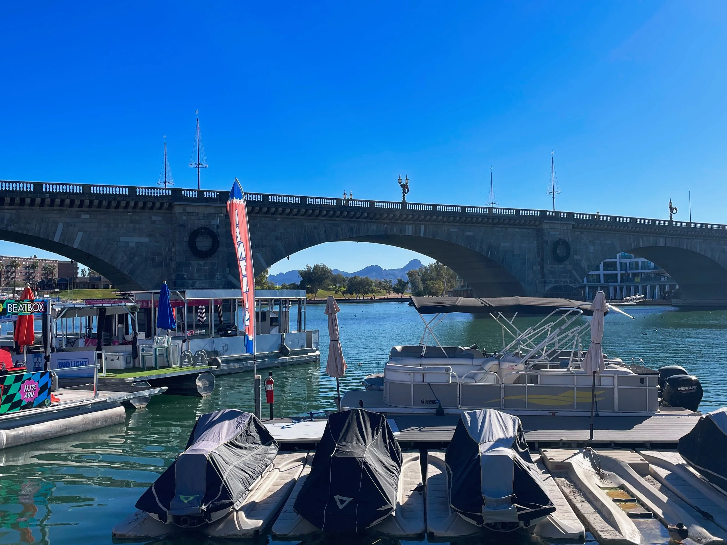
Things to Do in Lake Havasu City
London Bridge: Lake Havasu City is home to the relocated London Bridge, shipped piece by piece from England and reassembled here in the desert. Whether you find it fascinating or baffling, it’s worth seeing once. Walk across it, then follow the stairs down to the quirky waterfront village still milking its London ties with Brit-style pubs and souvenir shops.
Grab a coffee: I’d recommend the Dutch Bros drive-thru, as it’s en route out of town.
Afternoon: Kingman, Arizona
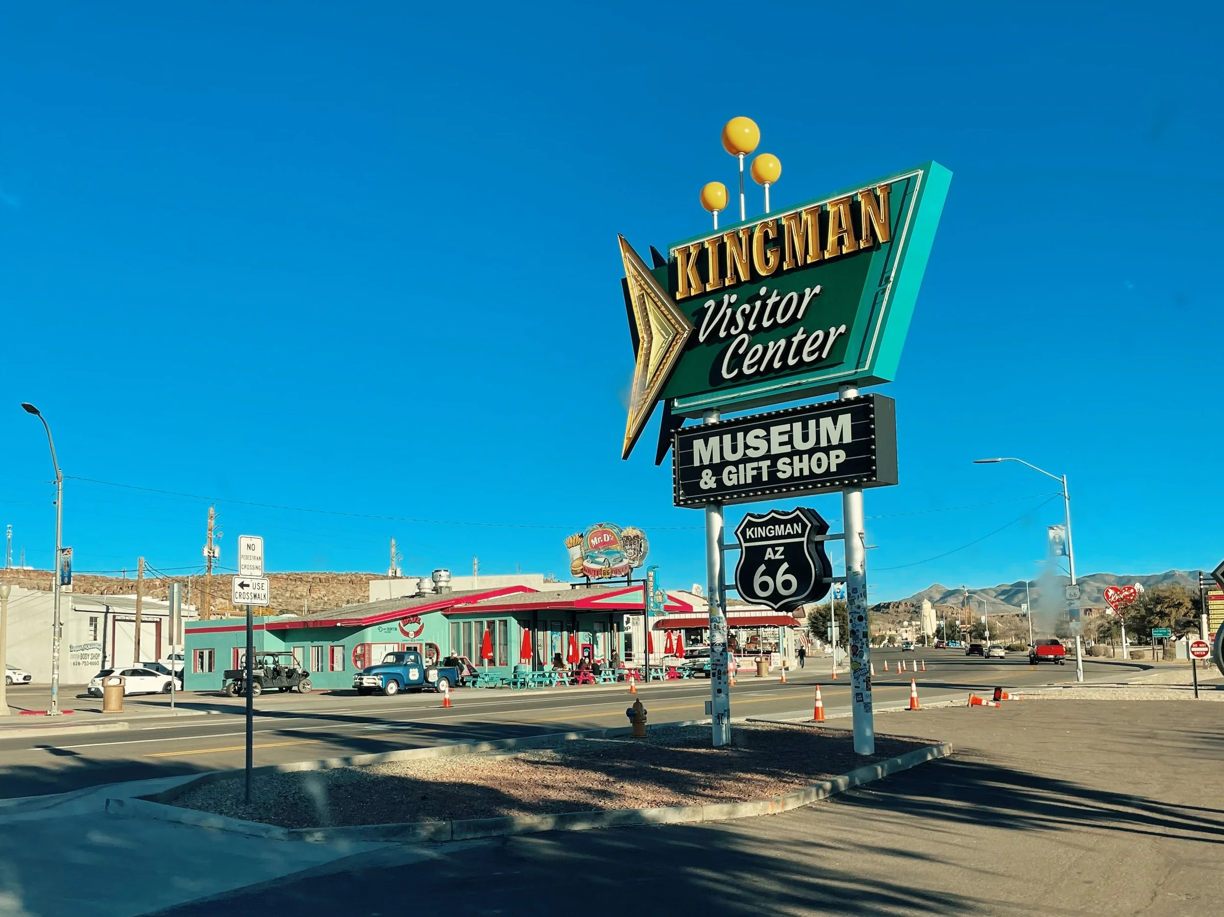
Kingman is one of the most important towns along Historic Route 66, recognized as the “Heart of Historic Route 66" due to its central location on the longest remaining, continuous stretch of this famous highway. It’s also a great place to slow down after a long drive.
Things to Do in Kingman
Visit the Route 66 Visitor Center & Museum inside the historic Powerhouse Building, then pick up a souvenir at the gift shop on your way out
Explore downtown Kingman with its vintage shops, Route 66-themed local eateries, and distilleries, including Mr. D’z Route 66 Diner, Desert Diamond Distillery (Arizona’s oldest!), and Antares Point Visitors Center & Gift Shop
Visit the Kingman Railroad Museum to see model trains and railroad artifacts in the historic 1907-built depot
Overnight: Little Old Wine Drinkers Winery (outside Kingman, AZ)
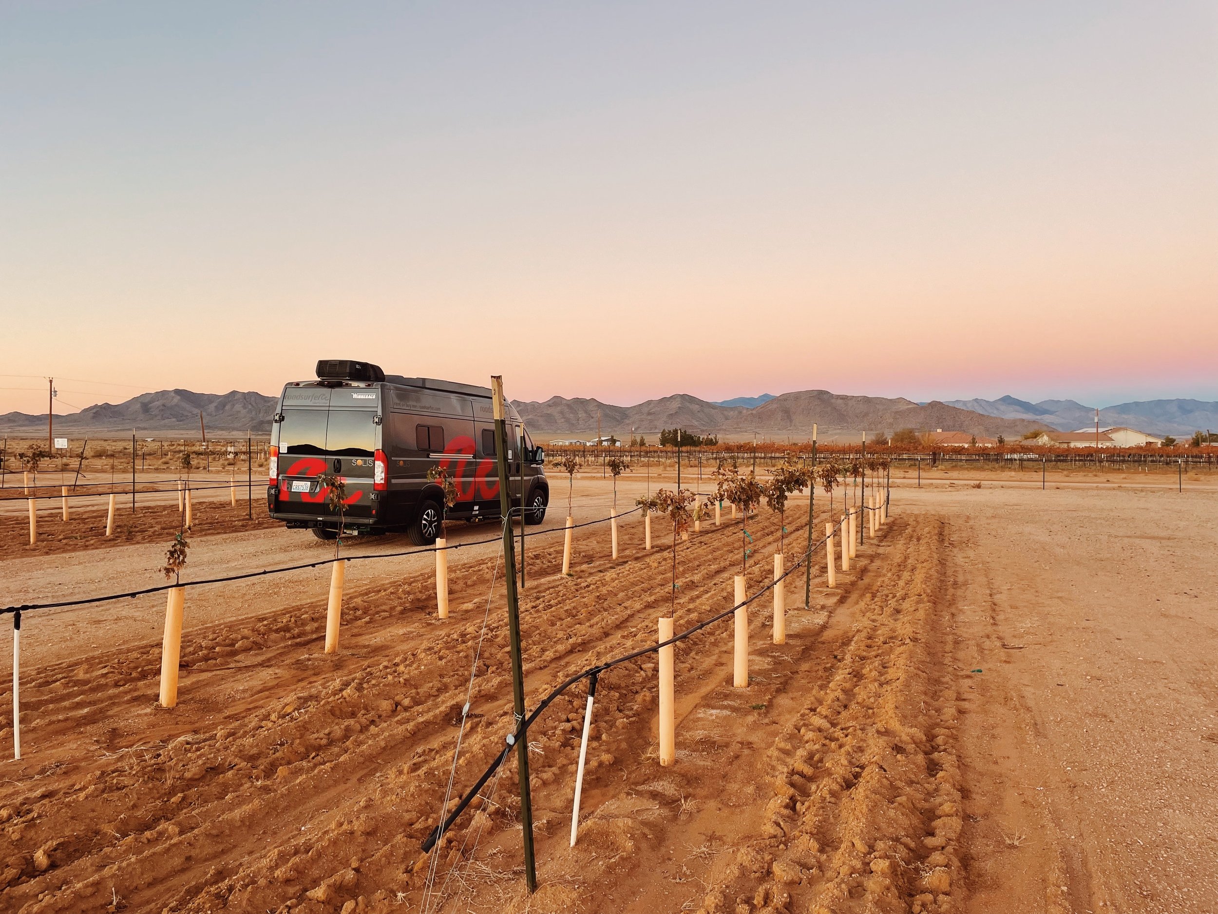
Booking: Reserve through the RV Overnights or Harvest Hosts
Why it’s special: Park overnight among the vines at a small, welcoming winery, get a tour of the vineyard, and a complimentary wine tasting (plus storytelling) from Steven, the owner
Optional upgrades: Electric and water hookups available for an additional fee
This stop adds a relaxed, social note to the end of a long driving day and is a memorable alternative to a standard RV park or campground.
Day 7: Kingman to Prescott, Arizona
Overview: Today trades Route 66 nostalgia for mountain curves, forest air, and one of the most meaningful memorial stops on the trip. The drive climbs steadily into central Arizona, shifting from desert basins to ponderosa pine-covered mountains and ending in one of the state’s most charming historic towns.
Route at a Glance
Start: Valle Vista / Kingman, AZ
End: White Spar Campground in Prescott, AZ — check availability (Recreation.gov) or get directions (Google Maps)
Recommended route: Route 66 → I-40 → US-93 → AZ-71 → AZ-89
Total drive time (no stops): ~3 hours
Why this route: This drive is all about the journey. The highway into Yarnell winds up a mountain with sweeping valley views, then continues through cooler elevations and forested landscapes as you approach Prescott.
Stop: Yarnell Fire Memorial
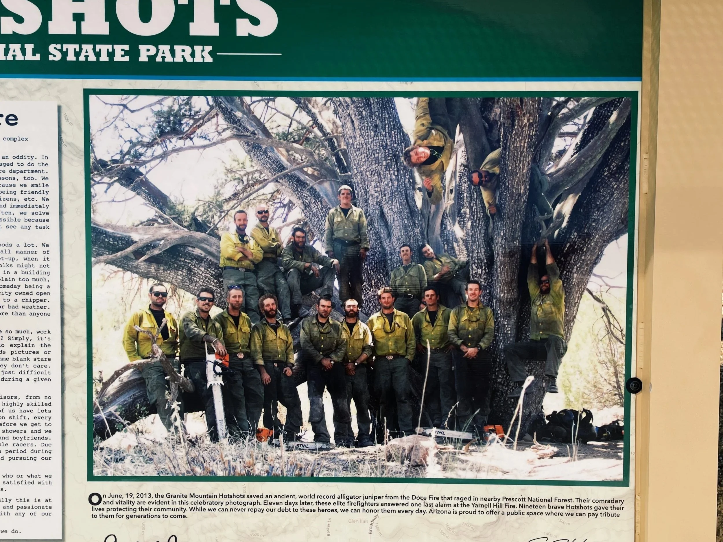
The Yarnell Hill Fire Memorial honors the 19 members of the Granite Mountain Hotshots who lost their lives here in 2013.
The access road itself is incredibly scenic, with tight curves and a dramatic overlook of the valley below
From the parking area, you can:
Take a short, ~15-minute walk to reach the first memorial plaque, or
Commit to the longer hike up (7 miles roundtrip) to the fatality site for a more immersive and sobering experience
Even if you don’t do the full hike, the memorial is deeply moving and well worth the stop. You’re likely to bump into firefighters and other first responders paying their respects, like I did. You can read all about that totally unexpected moving moment in Part 3 of my Southwest Road Trip Travelogue.
Note: Bring water and sun protection even if you’re just walking the 15 minutes to the first plaque—this area can be hot and exposed, especially outside winter months, and it’s extremely steep.
Scenic Drive: Into the Mountains and Forests
After Yarnell, the road continues through winding mountain terrain and into the Prescott National Forest.
Expect cooler temperatures and a noticeable shift in vegetation
Long, curving stretches through pine forest make this one of the most enjoyable driving days of the trip, albeit a 30mph one.
This section feels worlds away from the desert landscapes earlier in the itinerary.
Afternoon: Prescott, Arizona
Prescott is a lively historic town with a strong sense of place, blending Old West character with a creative, modern energy.
Things to do in Prescott
Wander the downtown historic area lined with shops, galleries, and historic buildings
Visit the famous Whiskey Row, home to classic saloons and deep Arizona history
Stop for a coffee at Wild Iris Coffeehouse & Bakery, a beloved local spot with an innovative latte menu, a tempting lineup of homemade pastries, and lunch fare.
Prescott’s compact downtown makes it easy to explore on foot once you arrive. You can park for free in front of the courthouse.
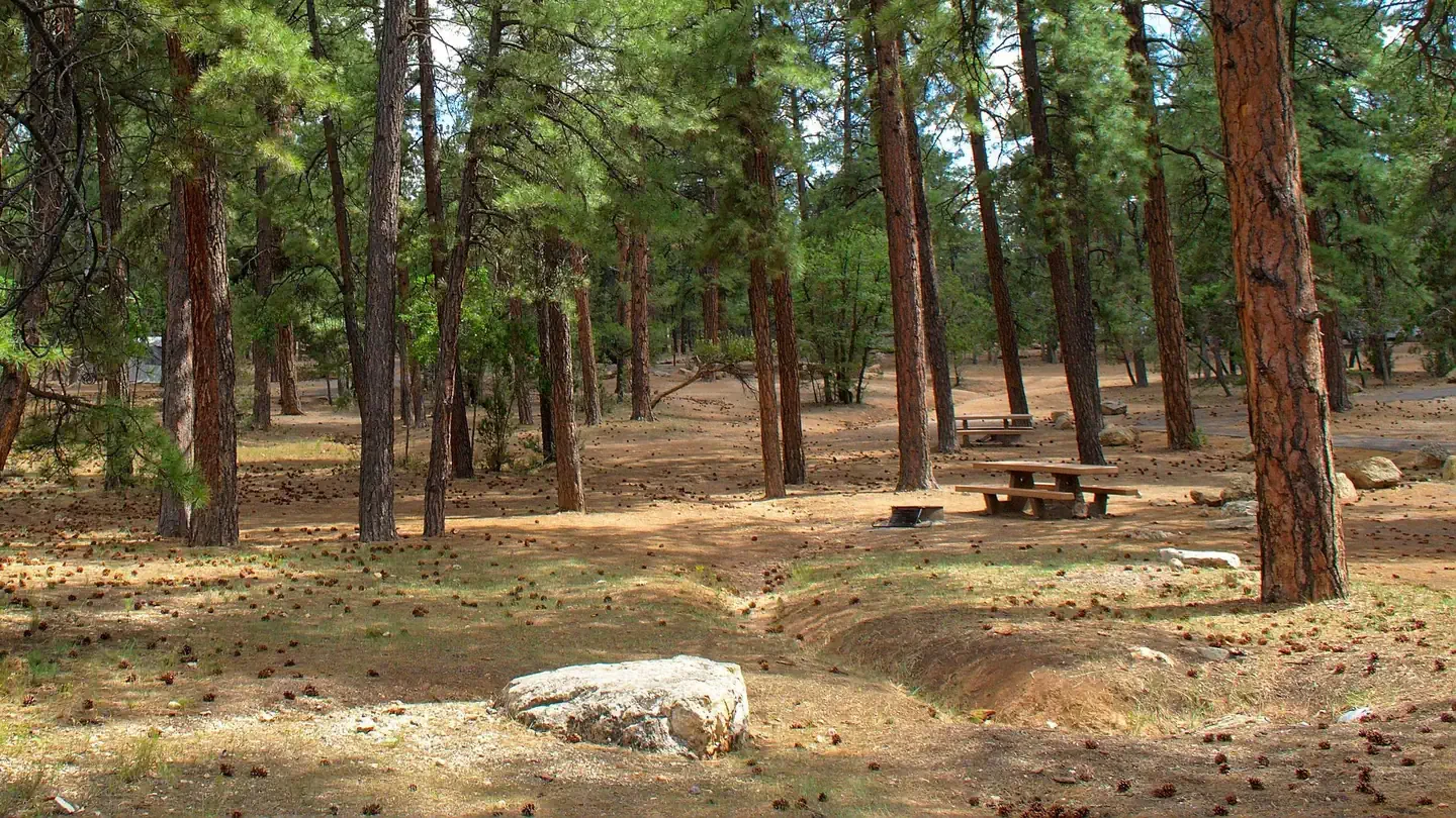
Overnight: White Spar Campground
Suitable for: Campervans, RVs (up to 49 feet), and tents looking for a quiet, wooded setting
Location: Prescott National Forest, ~5 minutes from downtown Prescott
Booking: Reserve through Recreation.gov
Booking Tip: Read the reviews for each site before reserving yours, as some sites don’t have anywhere flat to park (like site 8 for example)
Why stay here: A rare combination of convenience and immersion—you’re literally five minutes from Prescott’s historic downtown but fully surrounded by forest with access to hiking trails from camp
Facilities: Vault toilets, no hookups or dump station, water spigots throughout campground (though turned off December through February), limited to no cell signal
Day 8: Prescott to Grand Canyon National Park (South Rim)
Overview: Today delivers one of the biggest visual payoffs of the entire trip. You leave the pine forests of Prescott and head north to the Grand Canyon—an arrival that still feels monumental no matter how many times you’ve seen photos. The key today is smart logistics: park once, walk the rim, and let the free park shuttle do the rest.
Route at a Glance
Start: White Spar Campground, Prescott, AZ
End: Mather Campground, Grand Canyon National Park (South Rim) — check availability (Recreation.gov) or get directions (Google Maps)
Recommended route: AZ-89 → I-40 → AZ-64
Optional Route 66 detour: For a taste of nostalgia, veer off I-40 through Williams on the historic Route 66. It’s not much of a detour and adds a classic roadside experience, where you could park and walk the Main Street of this charming Route 66 town, before continuing to the Grand Canyon.
Total drive time (no stops): ~2.5 hours
Why this route: A straightforward northbound drive that trades winding forest roads for open high-country highways before entering the park near the main South Rim entrance.
Arrival: Grand Canyon National Park
Park pass required: Yes
America the Beautiful pass accepted
Otherwise, purchase a Grand Canyon National Park entrance pass
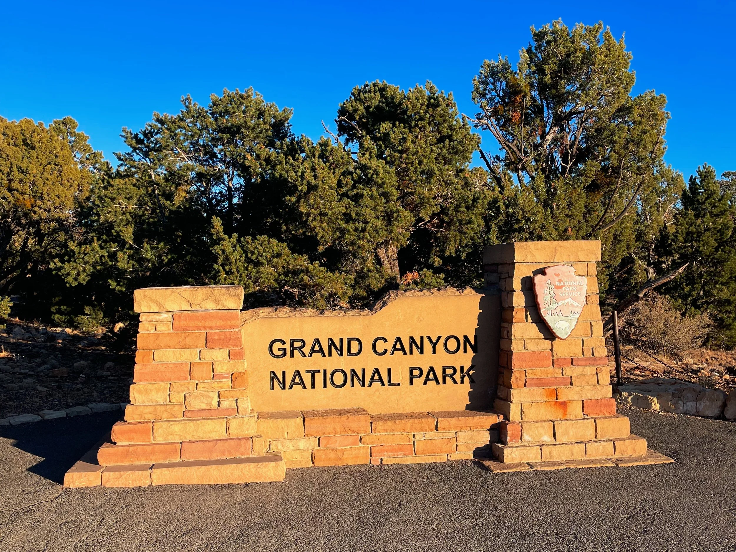
Plan to arrive midday or early afternoon to get oriented, set up camp, and still have time to explore the rim before sunset.
Afternoon Walk: South Rim Highlights (What I Did)
This point-to-point walk lets you experience some of the most iconic viewpoints without backtracking.
Park at the Visitor Center
Start at Mather Point for your first canyon views (a five-minute walk from the Visitor Center parking lot)
Walk the South Rim Trail toward Grand Canyon Village (about 2.6 miles)
Mostly paved and relatively flat
Pass multiple scenic overlooks, viewpoints, and historic buildings along the way
End at Bright Angel Trailhead (another 0.7 miles)
A major landmark and gathering point in the village
I recommend walking the trail at least to the first tunnel (go to the second tunnel if you have more time), then turn around. The full trail (down to the canyon floor and back up) takes a day to hike. It’s an entirely different experience and perspective being in the canyon versus on its rim!
Return via Free Park Shuttle
Catch the shuttle from Grand Canyon Village back to the Visitor Center
This approach minimizes driving, avoids parking headaches, and keeps the focus on walking and viewpoints.
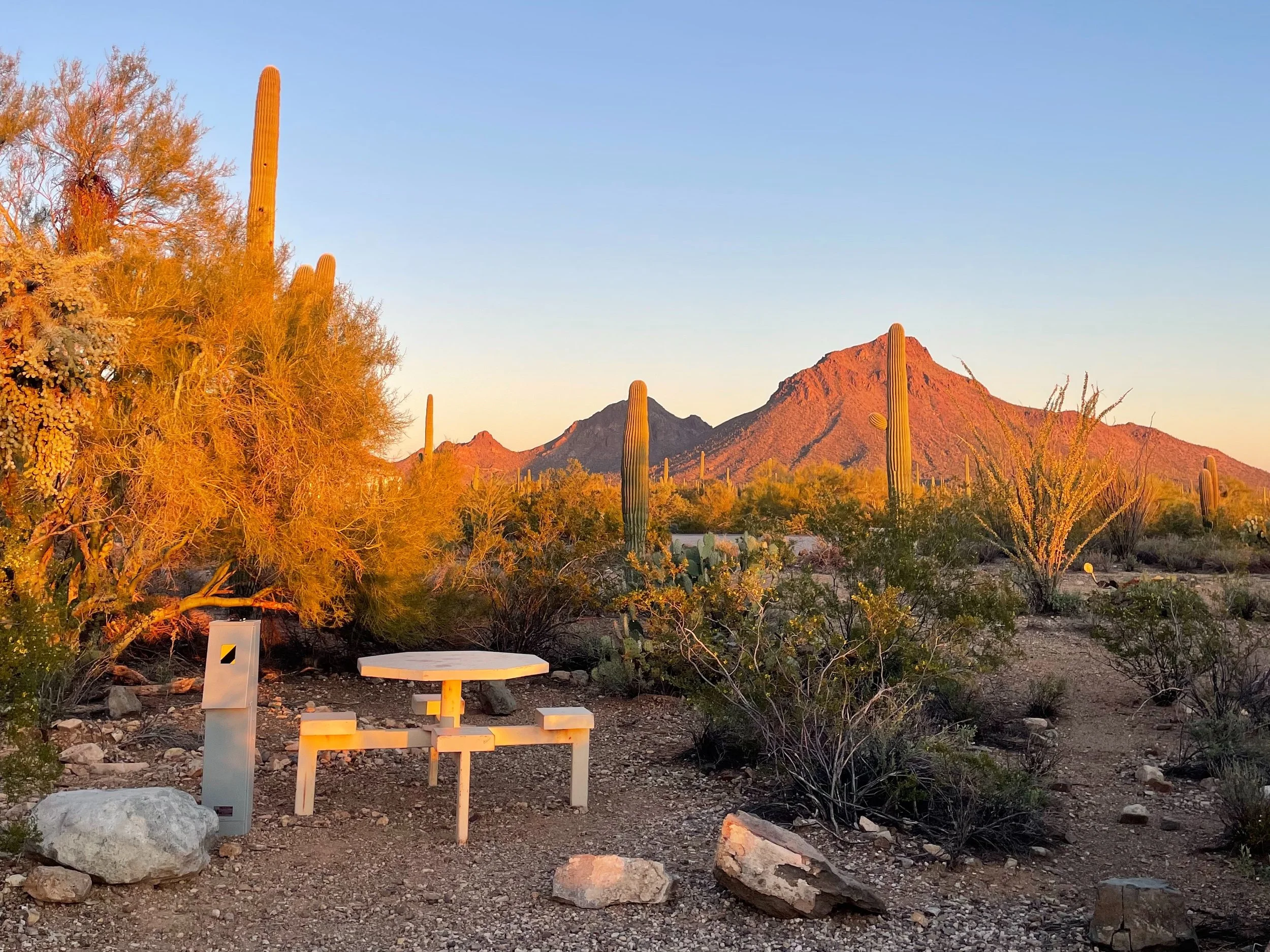
Sunset: Hopi Point
Why here: One of the few west-facing viewpoints along the South Rim, plus offers five views of the Colorado River
How to get there: Most of the year Hopi Point is only accessible by the park's free shuttle bus service (Hermit Road / Red Route) or a 2.5 mile (4 km) walk along the Rim Trail from Grand Canyon Village, but in December (when I visited), I was able to drive and park at Hopi Point (though parking was limited).
Tip: Whether your walking, shuttling, or driving to Hopi Point, arrive early—this is a popular sunset spot, especially on clear evenings.
Hopi Point is one of the best sunset locations in the park, with expansive views as the canyon walls catch the last light of the day. This was my view in early December.
Where to Camp: Mather Campground
Location: Inside Grand Canyon National Park (South Rim)
Suitable for: Campervans, RVs (up to 30 feet), and tents
Booking: Reserve via Recreation.gov (15 first-come, first-served campsites are available, the rest require a reservation)
Seasonal note: Only select loops are open in winter (December through February)
Why stay here: Mather’s central location makes it easy to explore the South Rim without constantly moving your vehicle. There’s even a shuttle stop at the campground.
Booking tip: Campsites book up quickly. I snagged one of the last available sites the day before, but booking well in advance is strongly recommended—especially outside winter months.
Facilities: Flush toilets, drinking water spigots throughout camp, dump station and potable water station, no hookups, generators allowed in all but Pine Loop, generally good cell signal
Rental van logistics: Mather Campground is an especially convenient final-night stop if you’re returning a campervan or RV the next day, thanks to the on-site dump station—making it easy to empty tanks before hitting the road for the return in the morning.
Day 9: Grand Canyon National Park to Phoenix
Overview: This is a straightforward return drive to Phoenix, but with enough flexibility to squeeze in one last Grand Canyon moment before departure and a worthwhile stop in Flagstaff en route.
Recommended route: AZ-64 → I-40 → I-17
Morning Options: One Last Look at the Canyon
Because the drive to Phoenix is about 3.5 hours without stops, you have time to explore a bit more of the South Rim before leaving.
Good low-effort options include:
A short sunrise or morning walk along the Rim Trail near camp. It’s only about a half hour walk (1.4 miles) to Mather Point from Mather Campground.
Revisiting a favorite overlook in different light, like Mather Point or Hopi Point at sunrise? Yaki Point, Yavapai Point, Ooh Aah Point, and Pima Point are other great spots to catch the sun rising over the canyon.
Midday Stop: Flagstaff
Route yourself through Flagstaff, a high-elevation mountain town that feels worlds away from the desert below.
Things to do in Flagstaff:
Browse local shops and bookstores, like Bright Side Bookshop, Sweet Shoppe Candy Store, and Babbitt’s Backcountry Outfitters
Grab coffee at Late for the Train, a cozy, well-loved café right downtown with an amazing Mexican mocha on the menu
Afternoon: Drive to Phoenix
From Flagstaff, continue south on I-17, descending from pine forest to red rock country and eventually into the Sonoran Desert once again.
This final stretch offers a satisfying visual bookend to the trip—ending where it began, but with a much deeper sense of Arizona’s landscape.
Planning for a different season?
While I designed and drove this route specifically for the winter months, it’s a classic Southwest loop that can be enjoyed year-round with a few tweaks.
Spring & Fall: These are ideal "shoulder" seasons. The route remains the same, but bring extra layers for the chilly desert mornings.
Summer: Proceed with caution. The desert sections (Saguaro, Joshua Tree) see extreme heat.
If you travel in July or August:
Only hike at sunrise or late evening.
Drink at least 1 liter of water per hour with electrolytes, and turn around as soon as you’ve consumed half of your water supply
Acclimatize to the heat before attempting long hikes and know the symptoms of heat exhaustion.
Monitor for flash floods during monsoon season.
Book campgrounds far in advance, as coastal travelers head inland.
If you enjoyed this 9-day Southwest road trip route, check out my Road Trips & Van Life collection, where I’m sharing travelogues from the road, more road trip itineraries I’ve tried and tested, plus tips and resources for road tripping and van life.
Road Trip Resources That Give Back to the Blog
This blog survives and thrives on affiliate links, but only ones I’ve road-tested and would recommend myself. This means that with every purchase you make through my links, I receive a small commission at no additional cost to you. Thanks for your support!

If traditional campgrounds are booked or you want a more unique overnight spot, Harvest Hosts lets you stay at wineries, farms, breweries, and more across North America. Membership pays for itself in a night or two.

AllTrails Plus makes it easy to find and follow hikes, even with spotty service. I love that you can download maps, read trail reviews, filter by difficulty, and check the latest trail conditions before you set out. It’s a must-have app for planning hikes on the go.
Try AllTrails+ and unlock premium maps, downloads, and trail insights for your next hike.

From flight delays to trail injuries to lost gear, World Nomads covers the kinds of hiccups that can happen on an adventurous road trip. Their travel insurance includes medical, trip interruption, and gear protection — all with flexible plans you can extend on the road. For solo travelers especially, it’s smart peace of mind.
Get a World Nomads quote and protect your trip before you hit the road.
For a full list of recommended travel gear and resources that help support the blog, check out my Travel Resources page or my Latest Deals & Discounts page, where I gather current sales, discount codes, and savings on the gear, brands, and memberships I recommend for road trippers and travelers.
Read My Southwest Road Trip Travelogue
This is where I went beyond the step-by-step itinerary and shared what it was actually like to travel by campervan around the American southwest solo, the highs, the lows, and the moments that will stick with me forever.